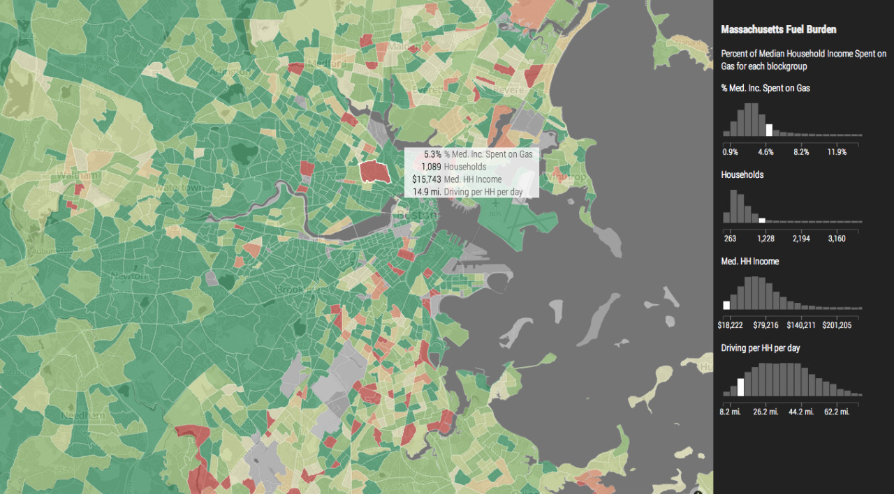
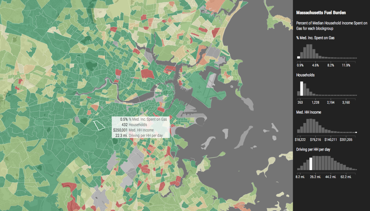
Massachusetts Fuel Burden
As a final project for MIT’s Spatial Database Management and Advanced Geographic Information Systems class, I created an interactive map to explore the impact of possible fuel taxes. A user could select a block group and see statistics about the percent of median income spent on gas, vehicle miles traveled per day, income, and number of households, as well as how this blockgroup’s statistics compared to other blockgroups in Massachusetts.
Using PostGIS, I joined spatial vehicle registration data to census block groups. Through Mapbox and D3, I created an interactive map that highlighted specific information about each blockgroup and which “bin” it fell into in a series of histograms.